
Murfreesboro ZIP Code Directory Coverage
Murfreesboro has seven postal ZIP codes in the official locality set: 37127 through 37133. The postal material identifies each with Murfreesboro, Tennessee, but it does not provide a verified neighborhood-by-neighborhood or city-limit crosswalk. That is why the area descriptions here remain conservative. Confirm a specific address in the postal tool before treating a ZIP code as a delivery answer.
| ZIP | Areas covered | Post office label | Research note |
|---|---|---|---|
| 37127 | Specific streets require USPS confirmation | Murfreesboro, TN | Postal bulletin locality code |
| 37128 | Specific streets require USPS confirmation | Murfreesboro, TN | Routing differs from some other local codes |
| 37129 | City and county mailing uses appear in official records | Murfreesboro, TN | Added in the documented 2018 notice |
| 37130 | Central physical-office addresses use this code | Murfreesboro, TN | Common city and county last line |
| 37131 | Exact served area not located | Murfreesboro, TN | Included in the official seven-code set |
| 37132 | Address-specific delivery use needs confirmation | Murfreesboro, TN | Institutional or campus use is a lead, not a finding |
| 37133 | Postal box and city mailing clues | Murfreesboro, TN | Official city pages use this PO Box code |
A ZIP code does not settle whether a parcel lies inside Murfreesboro. City Hall and County Clerk addresses use 37130, other official county addresses use 37129, and City Court mail uses PO Box 1985 in 37133. Those examples show postal practice, not exact ZIP boundaries.
Check a Murfreesboro ZIP Code by Address
The USPS ZIP Code Lookup is the official place to check a full delivery address or city and state. It is not a person search and should not be used to guess a parcel’s municipal status. Save the input address, returned ZIP, locality line, and the date of the search when comparing old records.
The USPS ZIP Code Lookup form provides the postal layer for a local address check.
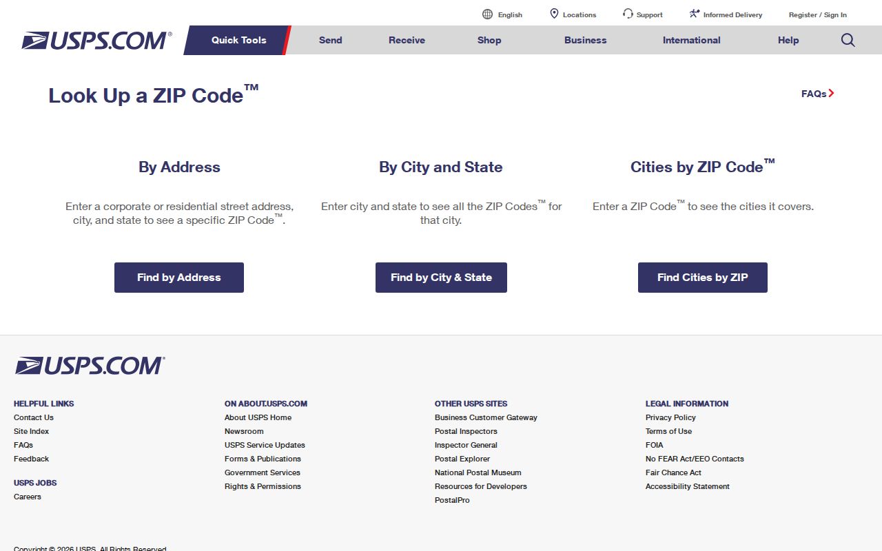
A postal result answers how mail is routed. It does not identify an owner, prove occupancy, or replace the assessor’s situs field. Where an old directory or deed uses another last-line ZIP, preserve the original form rather than silently changing it.
| USPS input | What it answers | What it does not answer |
|---|---|---|
| Street address | Delivery ZIP and locality response | City incorporation or parcel ownership |
| City and state | Postal lookup starting point | A complete street inventory |
| Returned ZIP+4 | More precise mail routing for the entered delivery address | A legal parcel boundary |
Older Murfreesboro ZIP Labels Differ
Postal bulletin material documents a 2018 locality-label change affecting the seven-code set. One official archive groups 37127, 37130, 37132, and 37133 with Murfreesboro 37130, while 37128, 37129, and 37131 route to Murfreesboro 37129. The 2018 notice identifies 37129 as newly added in that notice. An older record can therefore show a different preferred last line without proving that the physical place changed.
This local postal history is useful for family research, deeds, and historic correspondence. Keep the source’s ZIP as printed, then use USPS and parcel records to compare it with a current address. Do not assign named subdivisions or population totals to a ZIP without a current postal, Census, or local GIS source.
Note: A mailing-line difference is a research lead, not evidence that an address was renumbered, annexed, or transferred.
Murfreesboro ZIP Code 37133 Clues
ZIP code 37133 is part of the official Murfreesboro set and appears on city PO Box mailing addresses, including the City Court PO Box 1985 example in official city material. That makes it a useful mailing clue when comparing correspondence, court notices, or archived records. It does not establish a physical parcel, a delivery route, or the location of a person or office without a complete address check.
Keep a PO Box line separate from the situs field on a property card. If the research question is about the physical place behind a mailing address, use USPS to confirm the postal information, then ask the proper city or county custodian for the record associated with the actual street address or parcel.
Find Records Within One ZIP Code
A ZIP can narrow an address task, but the county portals do not provide a simple public ZIP-wide resident roster. The county Assessor’s visible Quick Search uses owner, address, and map-and-parcel options. Its address search becomes useful after USPS returns a full address. If a ZIP-filtered public record set is needed, ask the Assessor or GIS custodian whether the requested field means postal delivery ZIP, parcel situs ZIP, or owner mailing ZIP.
The county Assessor Advanced Search can narrow results by owner, street, parcel, value, size, sale date, neighborhood, and transfer book or page. Several option lists are dynamic, and the visible public form does not show a ZIP control. A defined request is safer than an assumed ZIP search: state whether real or personal property is wanted, name the date range, and ask whether the custodian can export a field that matches the intended geography.
- Enter the complete address in USPS and capture the returned ZIP and locality.
- Search the address in the Rutherford Assessor Quick Search to identify the public parcel card.
- Use the parcel in the Rutherford County GIS viewer and turn on city-limit context.
- For a verified public-record request, state whether the needed ZIP is delivery, situs, or mailing and ask the custodian for the available scope and fee.
Once the result is narrowed to a named road or parcel, the Murfreesboro by-street directory has the fuller address and deed workflow.
Murfreesboro ZIP Code Property Fields
Tennessee Property Assessment Data has an advanced-search interface with County, Owner, Property Address, Subdivision, Classification, Sale Date, and Parcel ID fields. Its coverage note routes Rutherford County research to the county system. The county Assessor portal supports the needed local property card, but its visible Quick Search does not expose a ZIP field. Search the address after confirming its ZIP instead of assuming a postal code is a county search filter.
The Tennessee Property Assessment Data search illustrates the statewide field choices and the Rutherford routing notice.
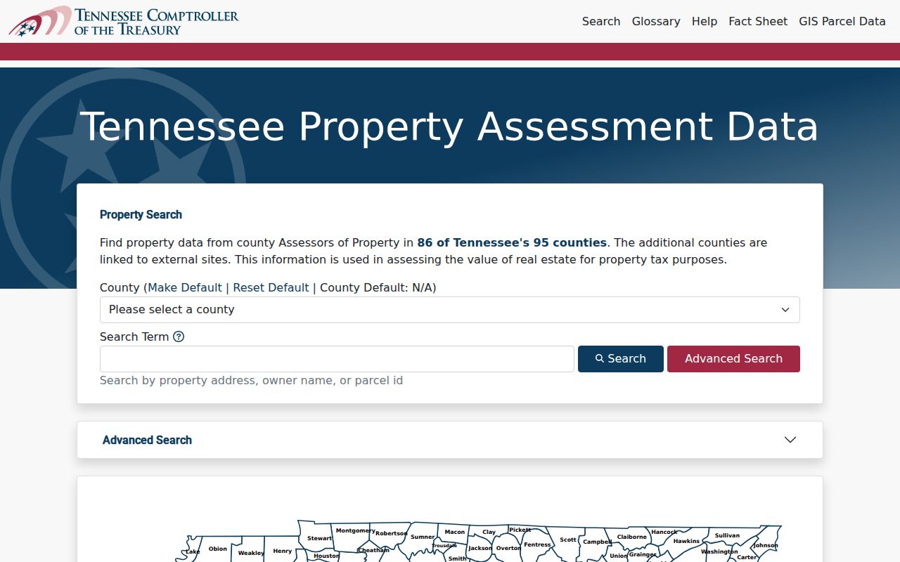
The fields are useful for explaining the difference between a property search and ZIP geography. A property-card result can show a parcel relationship, while postal delivery and municipal limits require separate checks.
| Property search field | Use for a ZIP-related question |
|---|---|
| County | Select the proper jurisdiction before testing a property record |
| Property Address | Run after USPS confirms a delivery address |
| Subdivision | Helpful only when the official record provides it |
| Parcel ID | Stable key when address text varies |
| Owner | Tax-record role, not proof of occupancy |
Murfreesboro ZIP Code Property Routing
The Tennessee Property Assessment Data site exposes statewide advanced-search fields, but its coverage guidance routes Rutherford County property work to the county system. That routing limit matters when a ZIP search starts on a state page. Use the county Assessor’s address or map-and-parcel path after USPS confirms an address, rather than treating the statewide screen as a complete Rutherford ZIP inventory.
When an address is near the municipal edge, open the county GIS parcel context and compare city-limit layers before requesting records. A postal ZIP, a county property card, and a city permit can describe different parts of the same address question. Preserve all three source dates when the records are being compared over time.
Murfreesboro ZIP Code and City Limits
Postal geography and city jurisdiction are separate. USPS determines mail routing. The assessor’s situs field links to a physical parcel. Rutherford County GIS and City GIS layers help test city limits, zoning, historic context, flood layers, schools, plats, and the urban growth boundary. County GIS data are not legally binding, so a boundary, easement, or parcel line that matters should be confirmed with the appropriate office.
Cityworks permits, city archive records, planning agendas, school-attendance tools, and utility-district boundaries each answer a different location question. A project record can identify a dated permit or participant, while an archive search can surface annexation or address history. None is a public household directory. For a boundary address, run the municipal and county workflows rather than selecting a custodian from the postal locality alone.
- ZIP and ZIP+4
- A ZIP identifies a postal delivery area. ZIP+4 adds a more precise mail-routing segment for an entered address.
- PO Box ZIP
- A ZIP used for postal boxes or a mailing location. It does not identify a physical parcel.
- Unique ZIP
- A code associated with one institution or delivery arrangement; verify its actual use by address.
- Carrier route
- A mail-delivery grouping used by USPS. It is not a municipal district or ownership map.
Boundary check. For an address near the city line, compare USPS, the Assessor parcel card, and city or county GIS before choosing the records custodian.
Request a Murfreesboro ZIP Code Record Set
Tennessee Public Records Act requests go to the custodian that holds the records. The Rutherford County general policy is not the catchall for every office: it excludes the Assessor, Register of Deeds, County Clerk, and specified court clerks. A narrow request should identify the record type, geographic field, time range, desired output, and whether inspection or copies are wanted.
For voter information, the statewide lookup requires County, First Name, Last Name, Birth Month, and Birth Year. It is an exact-record verification tool, not a street or ZIP browse tool. Public voter records have redactions, and the county Election Commission can explain current file availability, allowable fields, fees, and delivery format.
Note: Ask whether the requested ZIP reflects postal delivery, property situs, or owner mailing because those fields can produce different results.